Today we return to Arcade, in the municipality of Soutomaior, province of Pontevedra. We will take a walk of just over 1 kilometer by a pedestrian path from the Beach O Peirao (also called Muxeira Beach) beside the port and reaches the medieval bridge in Ponte Sampaio. We will go along the Ría de Vigo and then the River Verdugo at its mouth, passing by Matilde Beach and underneath the three bridges that cross the river.
Our previous visit to the port of Arcade: Click Here.

Coordinates to find the location of Soutomaior in Galicia. Extend the map and reach Arcade: 42.342759, -8.613688
We start the walk at the port of Arcade. We can see O Peirao Beach (also called Muxeira Beach). To the right of the picture, the fish market in Arcade and the Fishermen Association Virgen del Carmen.


Arcade belongs to the municipality of Soutomaior, is situated in the Ría de Vigo near the mouth of the River Verdugo. Today we will also see the fascinating effect of the tides in this beautiful place.
Soutomaior has 7300 inhabitants. It is divided into two parishes: San Salvador de Soutomaior, is the municipal capital and is located in the interior. It is one of its two urban areas and the Town Hall is there. On the other hand, the parish of Santiago de Arcade, the other urban area around the N-550 road.


O Peirao Beach (also called Muxeira Beach).


We can see to the left of the picture the port from where we started the walk.


We see the beach from this small dock (jetty?, pier?, quay?).


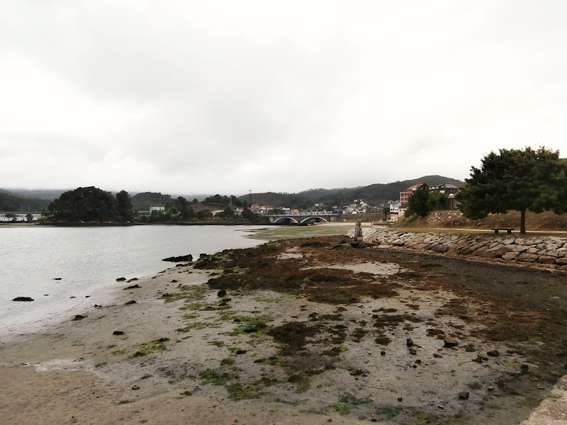
We see from the dock (jetty?, pier?, quay?) that the path continues along the Ría de Vigo. We also see in the background the bridge of the road N-550. That is the place where the River Verdugo flows into the sea as we will see later.

Before continue walking we look once again at the beach and the port.


The Ría at low tide. We have already seen these two small islands, they are the Alvedosas.


We are right beside Matilde Beach, next to the mouth of the River Verdugo.


We have reached the end of this Part 1.
Click Here for Part 2
No comments:
Post a Comment