Today we will walk the Way of Saint James between Triacastela and Samos. We will discover unforgettable places of this part of the Way in winter.

We can see in this link our pilgrimage by the Way of Saint James in Galicia from O Cebreiro: Click Here.
Coordinates to find the location of Triacastela in Galicia. Extend the map and reach our starting point in Triacastela: 42.756083, -7.235760
Triacastela:
It has about 750 inhabitants who engage in livestock but especially accommodate the pilgrims walking the Way of Saint James.
There are several hostels, privately owned, besides one of public ownership of Xunta de Galicia (https://en.wikipedia.org/wiki/Xunta_de_Galicia), guest houses, rural tourism houses, hospitality establishments and food shops aimed at attending to pilgrims at the time of well-deserved rest.
In addition Triacastela is located in an extraordinary natural environment with forests of chestnut and centenary oak trees and other native species that attract attention of visitors. They can make hiking trails and is expected in the future to visit an important archaeological site recently discovered and still under excavation.
We refer to the Cova de Eirós, Middle Paleolithic 35.000 years old. Cave paintings and remains of Homo neanderthalensis and Homo sapiens have been discovered. It is something unique in the northwest of the Iberian Peninsula.
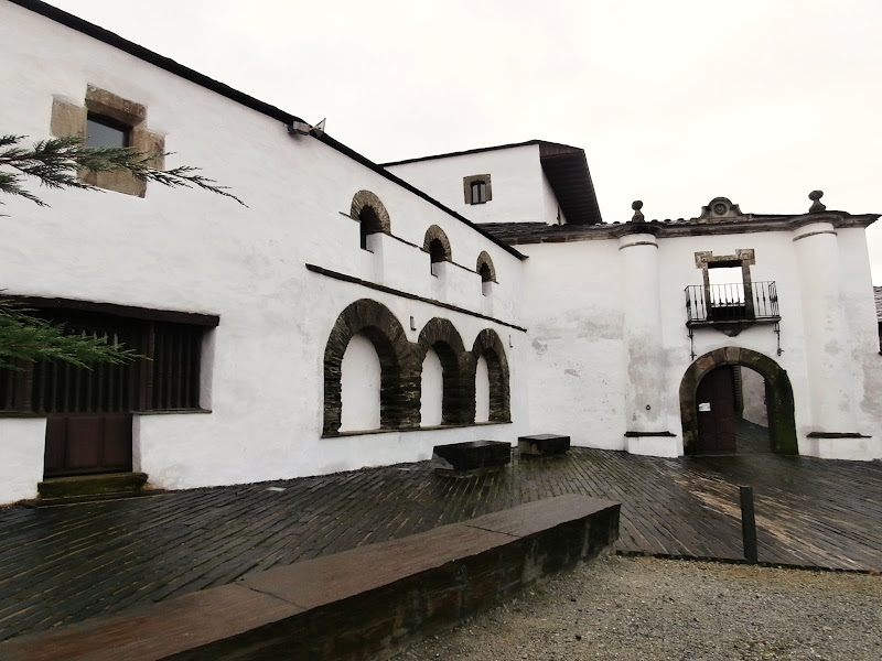
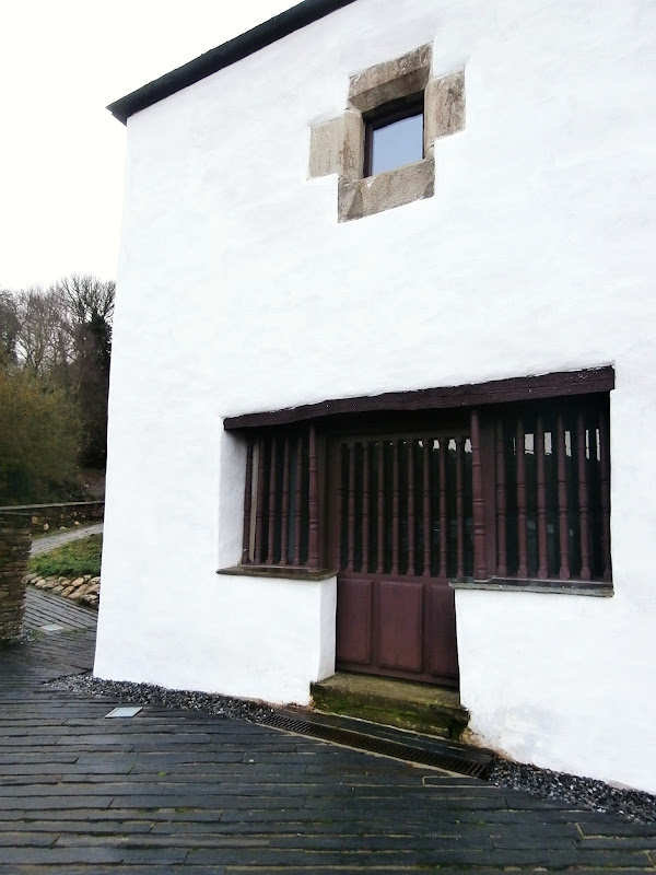
Upon entering Triacastela we see the hostel owned by the Xunta de Galicia. It offers 56 beds. It's in the Rua Peregrino (Pilgrim Street), close to the River Sarria also called Oribio or Oribio River also called Sarria.

The numbers shown underneath the photos are the map coordinates of the location from where each photo was taken.


View of Triacastela from the road LU-633. We can see to the left of the picture the tower of the church.

And this is other view of Triacastela from the road LU-633.

Now we leave the hostel and continue towards the center of Triacastela by the Rua Peregrino. We arrive at the parish church of Santiago, originally Romanesque (conserves Romanesque floor plan and the apse in this style) with a significant transformation in the 18th century, with the construction of the facade and the tower in 1790. It is made using slate, typical material in the area.

We see the facade and the church tower in three sections.

Statue of Saint James and the three bas-relief castles. They are the origin of the name Triacastela.

Porch at the entrance of the church.


We leave behind the church of Santiago we see a typical house with slate roof from the Praza da Eirexa (Church Square).

We go through the whole village and now we come to the place where the Camino forks by San Xil or Samos. This road sign explains it. To the left we will take the road LU-633 towards Samos or we turn right and crossing that road is the turnoff to San Xil.
The Way by Samos has the powerful attraction of the visit to the Monastery of Samos and th Capilla del Ciprés (Cypress Chapel) and by San Xil this stretch has its interest in being the original route of the French Way of the Pilgrimage Way. Pilgrims have at this point the possibility to choose.

This is the turnoff to San Xil.

Leaving Triacastela towards Samos the Way runs parallel to the road LU-633 along about 3 kilometres to San Cristovo do Real.
A fountain in the Way.

The Way runs parallel to the road LU-633.

Arriving at San Cristovo do Real we have to take a narrow road to the right that separates the Way of the road LU-633. However if we continue down the road about 600 metres further we will find a turnoff to the left. Another narrow road leads us to Casa Forte de Lusío.
It is a pazo (https://en.wikipedia.org/wiki/Pazo) built in 1551. It belonged to the family Vázquez Queipo de Llano. Vicente Vazquez Queipo de Llano was born there in 1804. He is author of logarithmic tables awarded at the Universal Exhibition in Paris in 1867, a prominent mathematician, physicist and politician.
There is a project to allocate part of the pazo to a museum dedicated to him. The building became property of the monastery of Samos at the express wish of the last owner of the family Vázquez Queipo.
The Monastery signed an agreement with the Xunta de Galicia to renovate and convert it into a hostel for pilgrims, a use that already had in the past. Because it was in ruins renovation was laborious. The aim was to use local materials such as chestnut and slate slab. Finally, in 2010 the hostel was opened. It offers 60 beds.


Pazo de Lusío is seen from the road LU-633.


We go back down the road and return to the place where the Way branches off it in San Cristovo do Real.
This is the turning off we will take.

There is a steep slope. We enter the village. Are seen the yellow arrows on the ground pointing the way to follow to pilgrims. As we know in this section of the Way the landmarks with the emblem of the scallop are not placed. This is because this is an alternative stretch. We can see those landmarks if we go to San Xil.

Now we arrive at the church of San Cristovo do Real. This parish is already documented in 1175.

We head to the bridge crossing the River Oribio (also called Sarria). There is a smaller second bridge.

We look downstream from the bridge.

And now we look upstream.

Leaving San Cristovo we are entertained taking pictures and a pilgrim caught up with us. Few dare in these winter dates and 3 degrees Celsius. He is a hero. We greet and he continues his way. Good trip. And Buen Camino.

Keep walking.

Looking behind us we see the last houses of San Cristovo do Real.

And the Way goes on.

End of Part 1.
Click Here for Part 2.
No comments:
Post a Comment